Download our flyer here. Contact Reggie Fay at MB&G to learn more about how we can help!
Tabular and spatial data are critical drivers of timberland valuations, but often times they are overlooked. Mason, Bruce & Girard (MB&G) understands the importance and can help you in your next timberland property due diligence.
It is important to consider the inherent risks and unknowns with the management of tabular and spatial forest inventory data. There is risk estimating the standing inventory and projecting inventories forward through time. How many acres were cruised? What field measurement procedures were applied? What growth model was used? How are productive acres assessed and calculated? Is the spatial data updated annually?
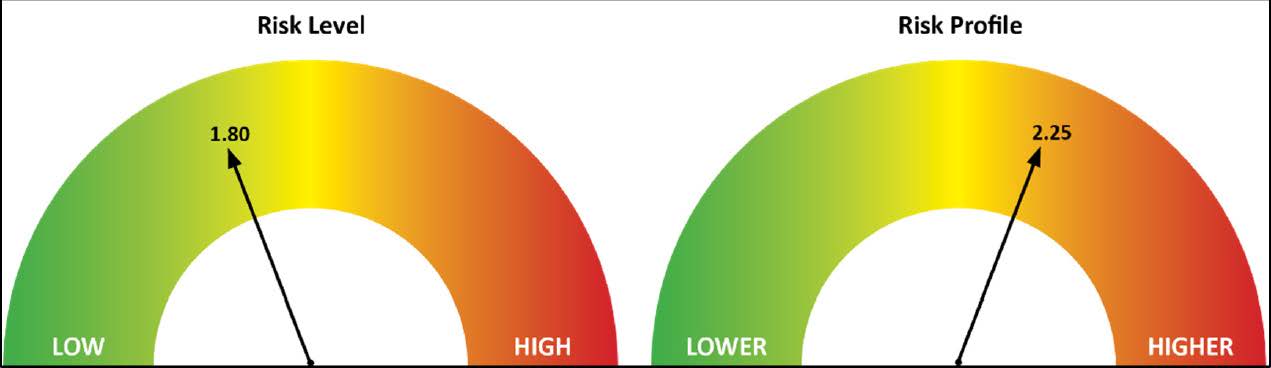
Easy to understand graphics can help you quickly digest the inventory and GIS risk assessment of the property as well as specific areas of interest.
MB&G has developed a qualitative and quantitative risk assessment to help you understand where problems may arise that could have financial impacts. We assess the complete forest inventory system, growth & yield models, and spatial data. We leverage our experience and provide our opinion of the system. We will let you know where the risk is and what, if any, improvements could be made.
MB&G’s assessment will provide you with quality data to make an informed decision.
Understand The Risk
Then an inventory and GIS risk assessment might be right for you!
MB&G is proud to support the 2026 John Aho Golf Tournament by donating a pair of MB&G-branded pickleball paddles and balls for the tournament’s silent auction. Hosted by the Northwest Oregon Subsection of the Pacific-Northwest Section AWWA (PNWS-AWWA), the annual tournament raises funds for the John Aho Memorial Scholarship Fund and Water For People, helping support future water professionals while expanding access to safe water and sanitation in communities around the world.
READ MOREWhether you’re an investor, natural resource professional, conservation practitioner, landowner, researcher, or student, this course will provide practical insights into the financial, economic, and market forces shaping the future of natural resources.
READ MOREOne of our foresters was out working by the South Umpqua River near Days Creek last week and spotted an Osprey nest. After observing the nest for awhile a baby osprey popped out to get some sun and they were able to capture this photo.
READ MORE

