Southern California Edison (SCE) was interested in a potential carbon sequestration program on their 20,000 +/- acres of mixed conifer, uneven aged timberland located near Shaver Lake, California. The timberland had been impacted by severe drought, beetles, and the 2020 Creek Fire, which impacted 2,500 acres.
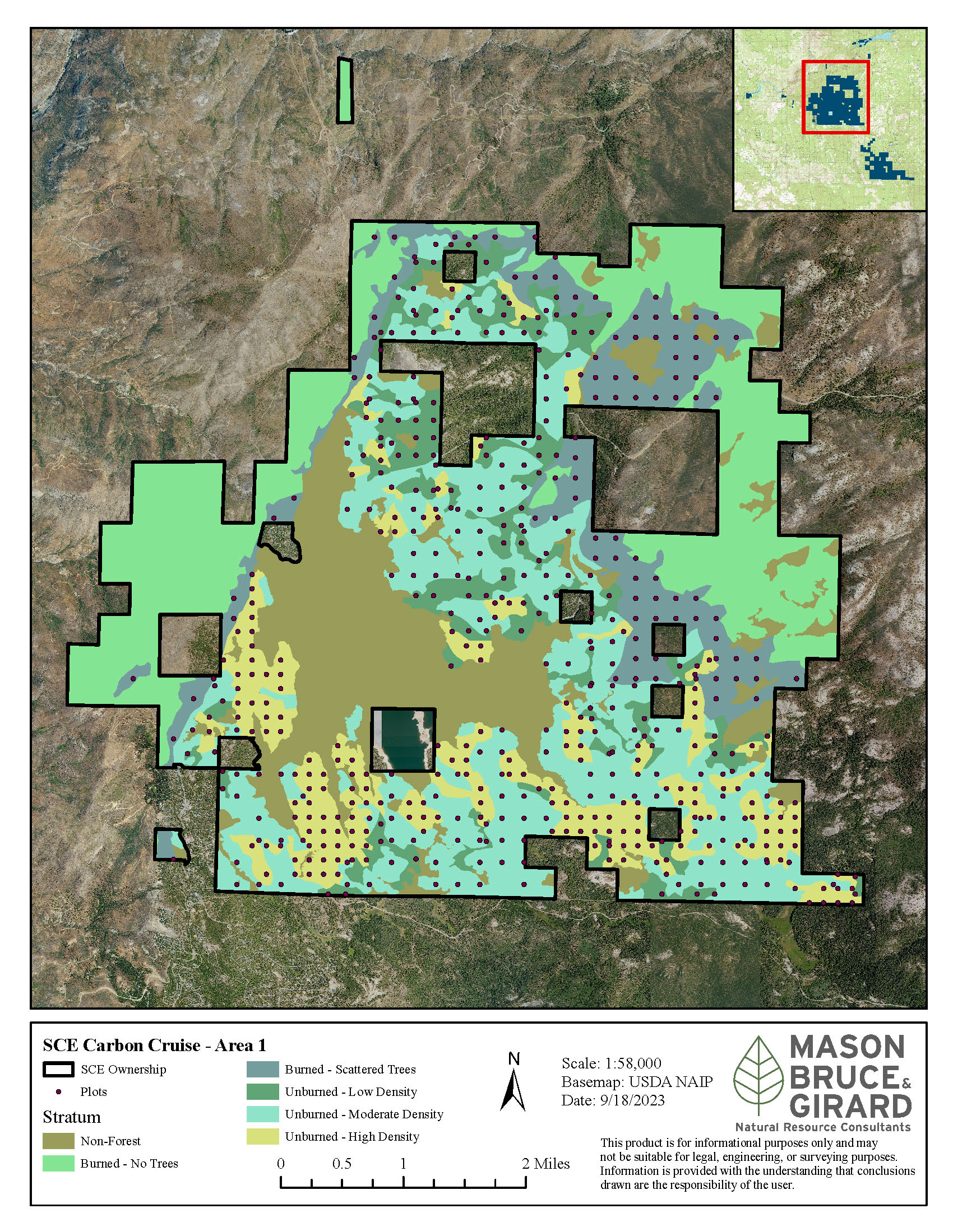
Mason, Bruce & Girard (MB&G) provided an updated and reliable forest inventory to assist with management decisions and the potential carbon project. MB&G designed a robust forest inventory, collected field data, compiled the results, and provided an updated database.
The forest inventory for the Shaver Lake tree farm was designed by MB&G to meet the precision and accuracy requirements of +/- 5% at the 90% confidence interval of carbon dioxide equivalent (CO2e). MB&G followed the sampling and measurement protocols outlined in the Climate Action Reserve’s Standard Inventory Methodology v1.0. All aspects of the project from design, data collection, analysis, and reporting were overseen by MB&G. A report summarizing the findings was provided to SCE, along with the inventory data collected.
MB&G assessed the area to understand the management history, existing data, variability, and project objectives. This included reviewing project goals and objectives with SCE, reviewing statistical precision and accuracy requirements, and reviewing project timelines. All information and data available was gathered, including tabular and GIS data. The stand boundaries were reviewed using aerial imagery and other GIS layers including roads and hydrology. The sampling area was finalized along with the net area calculations.
MB&G cruisers began collecting information. Cruisers navigated to within 50 – 100 feet of the target plot center and used a GPS unit to identify a bearing and distance to plot center. Then a compass and loggers tape were used to navigate the final distance and establish plot center where data was collected. At each plot, detailed tree measurements were captured and recorded on a tablet. A check cruise and field audit was conducted on a portion of the plots. The data was compiled and MB&G generated an updated forest inventory for SCE.
See our full project sheet here.
MB&G is excited to be at the Society of American Foresters National Convention in Tacoma, WA this week.
READ MOREMB&G’s Emmaline Bryant will be playing in the Parker Memorial Golf Tournament on Friday. Since 2008, Warnell’s Young Alumni Committee has raised more than $600,000 for the school through the golf tournament with support from the family of J. Reid Parker. As a Platinum sponsor this year, MB&G is pleased to support the school’s goal of increasing opportunities for experiential learning.
READ MORE